The tiny village of Ugashik is located 369 miles southwest of Anchorage, on the eastern shore of the Ugashik River. The nearby Ugashik Lakes are world renowned for trophy sport fish, and are key spawning grounds for seasonal sockeye and coho salmon. The Ugashik Narrows, a unique confluence where the two rivers of the Ugashik Lakes meet are a shallow, narrow river system world famous for its sport fish and recreational activities.
Ugashik is composed of Aleut, Sugpiaq and Yup’ik peoples. The name is a deviation from the traditional name place word “Oogashik”, which was first recorded as a community in 1880. Prior to the pandemic of 1919, Ugashik was once one of the largest villages in the region. Today, Ugashik’s population density is much different, the 2000 census reports the total population of just 11 people and a population density of 0.0 people per square mile. There were 7 households and 2 families. The racial makeup was 72.73% Alaska Native/American Indian, 18.8 % white, and 9.09% from two or more races.
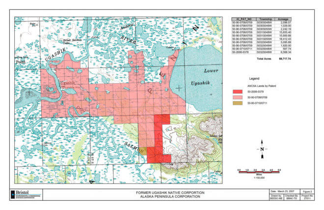
Ugashik’s total area is 248.7 square miles, 233.9 square miles being land and 14.8 square miles of water. APC owns a total of 69,717 acres around Ugashik.
To learn more about Ugashik, purchasing a land use permit or connecting with one of our recreational partner vendors, contact Lands and Resources management at (907)274-2433.

